

Home to 26 scenic byways, Colorado is one of the best states to explore on a motorcycle. From white-knuckle rides with hairpin turns and steep drops to serene spins through rolling grasslands, our selection of the state’s best two-wheel rides combines fantastic views, high-quality roads, and easy access to amenities and activities.
Cache La Poudre-North Park Scenic Byway
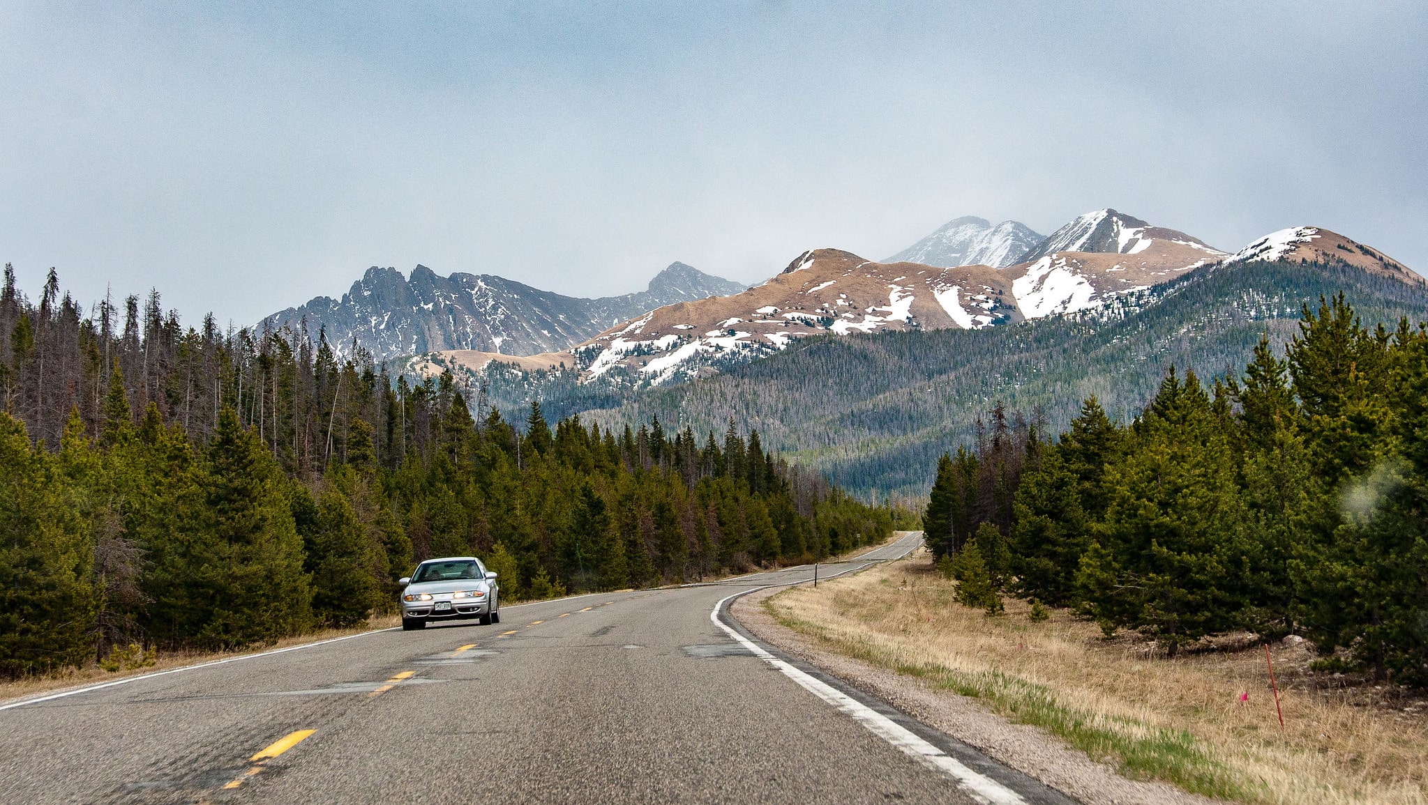 Cruising along the Cache La Poudre-North Park Scenic Byway. Photo by: Kent Kanouse
Length: 101 miles
Connecting the towns of Fort Collins and Walden, the Cache La Poudre-North Park Scenic Byway winds along the beautiful Cache La Poudre River through the Roosevelt National Forest. Along the way, enjoy the views from the 10,276 foot summit of Cameron Pass, and consider stopping at any number of great fishing and hiking spots throughout the journey. The entire route is paved and gently winding, making it ideal for motorcyclists.
For those starting the ride from the east, be sure to spend some time checking out Fort Collins. Visitors can find a vibrant downtown full of restaurants, craft breweries, bars, and galleries, along with the sprawling Colorado State University campus. On the west side of the byway, don’t skip out on exploring the North Park area of the Centennial State. Known as the Moose Viewing Capital of the state, State Forest State Park is a great spot to visit for a good chance at seeing moose and other wildlife.
Grand Mesa National Scenic Byway
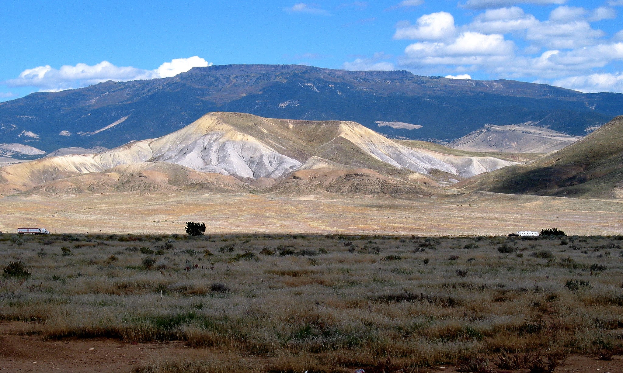 View of the massive Grand Mesa. Photo by: Martin Prochnik
Length: 63 miles
Spanning 63 paved miles between Mesa and Cedaredge, the Grand Mesa National Scenic Byway offers riders a chance to explore Grand Mesa, which is known as the largest flat-top mountain in the world. The route rises to around 11,000 feet at its highest point, and it passes within easy hiking distance of countless alpine lakes for some peaceful fishing.
It is not part of the official itinerary, but many visitors choose to tack on an additional 14-mile one-way trip to Lands End, where expansive views and a small observatory await. Though the main byway is entirely paved, motorcyclists should keep in mind that this addition is only partially paved and known to have lots of potholes.
Dispersed and paid campsites are available throughout the scenic journey. At the northern end, Mesa is a small town with limited options for accommodations and food, but Cedaredge at the southern terminus has ample hotels, bars, and restaurants. While passing through Cedaredge, consider paying a visit to The Pondy, a local dive bar with pool tables and a jukebox.
Mount Evans Byway
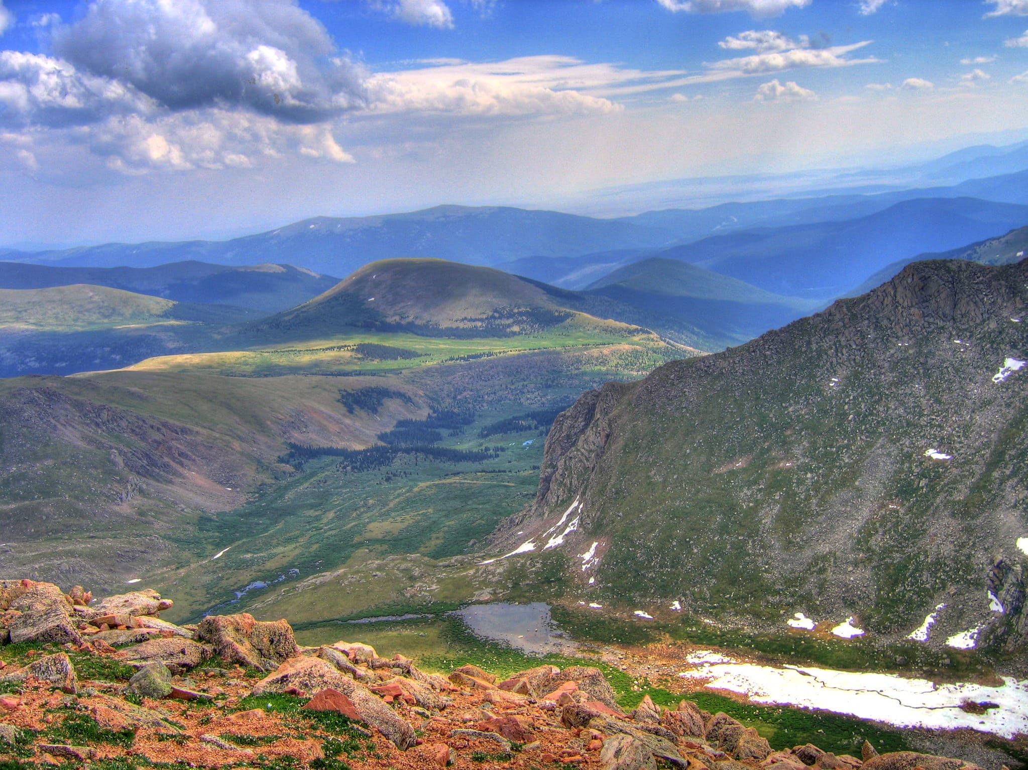 High elevation views on the Mount Evans Scenic Byway. Photo by: Shogun_X
Length: 28 miles
The highest paved road in North America, the Mount Evans Byway winds its way above 14,000 feet starting in Idaho Springs. The road is free to drive, but there is a per-vehicle fee for parking at the summit. Though the road to the top is paved, it features hairpin turns, sheer cliffs without guardrails, and limited smooth pull-offs, making it a good choice only for experienced motorcyclists.
On the way to the top, consider stopping at Echo Lake Park or Summit Lake Park, both of which are home to picturesque lakes. Summit Lake Park is located just before the last push to the peak, making it a great place to stretch your legs before embarking on the final ascent toward Mount Evans.
Bikers looking for a longer adventure should try out a detour to Evergreen via Mestaa’Ėhehe Pass. First established in 1923, this fully-paved road is a popular addition to trips to Mount Evans. In Evergreen, stop for a drink or snack at Bivouac Coffee, a local coffee shop owned and frequented by motorcycle riders.
Peak to Peak Byway
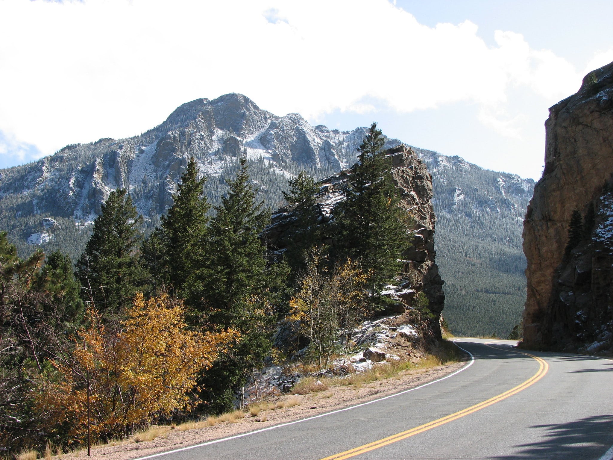 Peak to Peak Byway in Colorado. Photo by: TheBoyFromFindlay
Length: 59 miles
Colorado’s oldest scenic byway, the Peak to Peak Byway runs from Estes Park in the north to the casino towns of Central City and Black Hawk in the south. Known as “the showcase of the Front Range,” this route is easily accessed from Denver, making it an ideal weekend trip for riders of all skill levels. At 59 miles, this adventure can be finished in a couple of hours, but many choose to take their time and explore along the way.
Though open year-round, the Peak to Peak Byway is well known for beautiful views of foliage during autumn. Riders will pass through the quaint town of Nederland, where accommodations, bars, and plenty of good food can be found.
Activities along the way include fishing, hiking, and exploring any number of dirt roads that branch off from the main byway. Additionally, many visitors enjoy exploring the ghost towns of Apex and Nevadaville near Central City. In Black Hawk, be sure to stop for a bite to eat at The Last Shot, a family restaurant with dedicated motorcycle parking.
Pikes Peak Highway
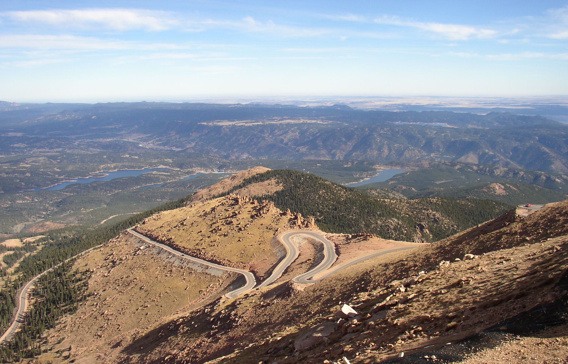 Switchbacks on Pikes Peak Highway. Photo by: Beverly Veach
Length: 19 miles
The highest toll road in North America, the highway to “America’s Mountain” makes a worthy addition to any motorcycle rider’s Colorado itinerary. Sitting at 14,115 feet, Pikes Peak is one of the most notable mountains on the continent. It’s easy to access from Colorado Springs, and the views from the top are hard to forget.
As expected, the Pikes Peak Highway is not for novices. With sharp turns and frequent drop-offs without guardrails, riders should be comfortable making tight, exposed turns before attempting this route. Though the whole road can be nerve-wracking, the most difficult part begins after the road ascends above the treeline.
From the Summit Complex parking lot, walk the few steps necessary to the true summit of the mountain. After taking in the breathtaking view, head inside the newly-renovated visitor center for interpretive signage and a bite to eat. The mountain is known for its famous donuts, but burritos, soups, and sandwiches are also available.
To avoid crowds, opt for a weekday trip to Pikes Peak, and always plan to start your adventure early. Summer is known for bringing frequent afternoon storms in the state, so a morning start is safer, more enjoyable, and less crowded.
San Juan Skyway National Scenic Byway
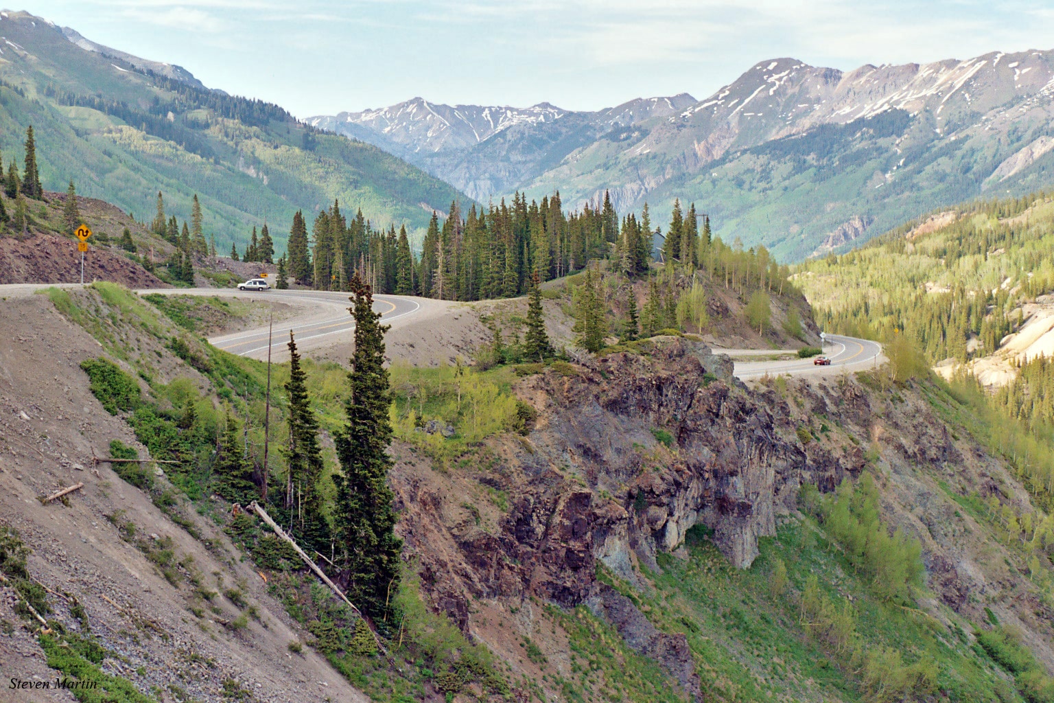 Portion of the Million Dollar Highway section near Red Mountain Pass. Photo by: Steven Martin
Length: 233 miles
Passing through the towns of Durango, Telluride, and Silverton, among others, the San Juan Skyway National Scenic Byway is one of the premier byways in the state. Spanning over 200 miles in length with plenty of camping and hotels located throughout, this route makes a perfect multi-day ride for motorcyclists looking for fantastic natural beauty and rich historical sites.
One of the highlights of the trip is the Million Dollar Highway. Running for 25 miles between Ouray and Silverton, this stretch of the road has some of the best views that Colorado has to offer. This section weaves across the Uncompahgre Gorge to the top of Red Mountain Pass. It showcases thrilling cliffsides, gorgeous fall foliage, and numerous scenic overlooks.
Along the byway, riders can stop for fishing, world-class hiking, and near-limitless exploration. Popular spots along the way include Ridgway State Park and Mancos State Park. In Durango, consider spending the extra time to check out the Durango and Silverton Narrow Gauge Railroad, and be sure to stop by for a drink at the Million Dollar Highway Saloon before leaving town.
Santa Fe Trail Scenic Byway
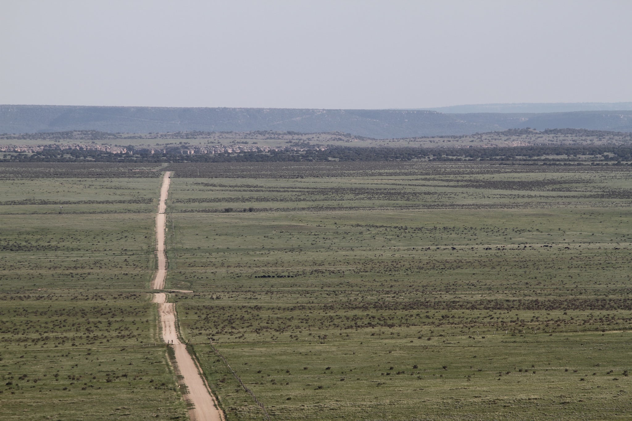 Aerial view of the Comanche National Grassland. Photo by: Charles Anderson
Length: 188 miles
Roughly following the original path of the historic Santa Fe Trail, the Santa Fe Trail Byway travels for 188 miles between the towns of Lamar and Trinidad in southeastern Colorado. Though not high in the mountains like most of the rides on this list, this serene route through the grasslands is a good addition to any itinerary with a few ghost towns along the way.
It can be ridden in either direction, but going from east to west gives riders the best views of the stunning Sangre de Cristo mountains. Loosely following the Arkansas River, the byway heads southwest from Lamar, passing through Las Animas. In this area, it’s a great idea to stop at John Martin Reservoir State Park for a look at the second-largest body of water in the state.
Further along, enjoy views of the Comanche National Grassland which is full of falcons, antelope, and beautiful fields of sunflowers in late summer. By the time the route reaches Trinidad at right around 6,000 feet, it has gained over 2,000 feet in elevation. From here, the historic Santa Fe Trail continues south, passing into New Mexico and over Raton Pass.
Trail Ridge Road Scenic Byway
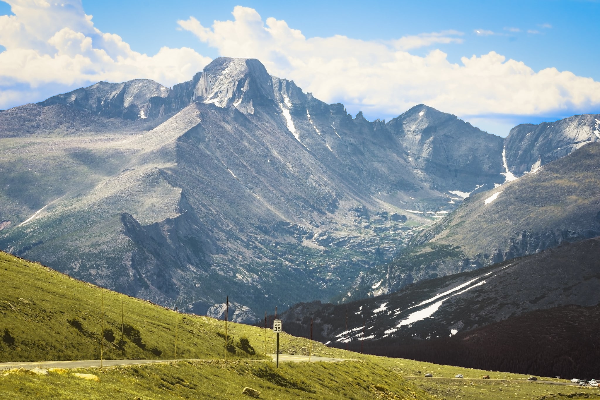 Stunning views of Rocky Mountain National Park on Trail Ridge Road. Photo by: www.bhattacherjee.com
Length: 48 miles
Located within the Rocky Mountain National Park, Trail Ridge Road Scenic Byway is an iconic Centennial State excursion. First opened in 1938, Trail Ridge Road connects Estes Park and Grand Lake, and has a peak elevation of 12,183 feet. Like many other high-elevation byways in the state, the road is open only during the summer months, and it typically opens up around Memorial Day each year.
There are no guardrails throughout the route, and the drop-offs can be steep, so stay alert throughout the journey. The entire byway is situated within the national park and the speed limit is quite low and definitely enforced. Additionally, traffic often backs up on this famous ride, so start early for the best chance at a solitary experience.
Along the way, stop at any number of scenic overlooks for jaw-dropping views of the mountains. The overlook at Fairview Curve is one of the most frequented, and it offers great vistas of the Never Summer Mountains. Trail Ridge Road is the perfect place for wildlife enthusiasts, as elk, moose, marmots, bears, and much more frequent the areas near the road.
On either end of the byway, both Estes Park and Grand Lake have plenty to see and explore. A number of popular bars and saloons can be found throughout downtown Estes park, including Wheel Bar and Lonigans Saloon. Grand Lake is a smaller town, but nonetheless, there is still plenty to eat and drink along Grand Avenue.
Top of the Rockies Byway
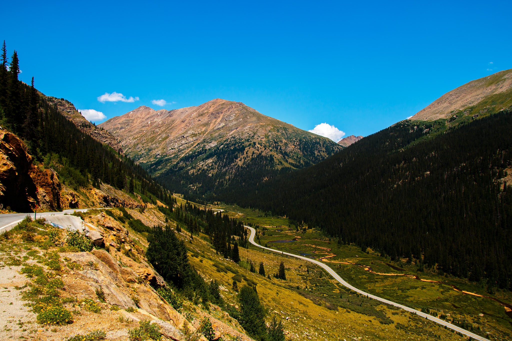 Independence Pass on the Top of the Rockies Byway. Photo by: Gene
Length: 115 miles
Navigating 115 miles between Copper Mountain, Aspen, and Minturn, the Top of the Rockies Byway passes through some of the state’s most remarkable areas. Crossing the Continental Divide multiple times, this byway barely dips below 9,000 feet and features striking views of both Mt. Elbert and Mt. Massive.
Beginning in Aspen, one of Colorado’s most famous ski towns, the route heads west and crosses its high point on Independence Pass at 12,095 feet. From here, the byway passes through Twin Lakes, a small town that provides excellent access to hiking and camping near Mt. Elbert.
The approximate center of the journey is Leadville, which is America’s highest incorporated town. Heading north from here, riders can choose to take one of two branches of the route. Staying on US-Highway 24 over Tennessee Pass ends up in Minturn, while branching off to Colorado Highway 91 leads to Copper Mountain.
One popular stop along the ride is Camp Hale Memorial, a former World War II training ground where soldiers trained to fight in the mountains of Italy. In total, the Top of the Rockies Byway passes through the Pike, San Isabel, and White River National Forests, and it provides unforgettable views, great riding, and world-class access to the backcountry.
Hopefully, this list has inspired you to start planning your next motorcycle adventure and see all that colorful Colorado has to offer. Enjoy your trip!